VisionAery

    Municipal & public works / Road flooding

    Standing water on the road, seen before a driver finds it.

    VisionAery Liquid Leak Detection runs on the traffic and intersection cameras a city already owns. It reports standing water appearing and growing at a sag point or an underpass to the TMC and to public works in seconds.

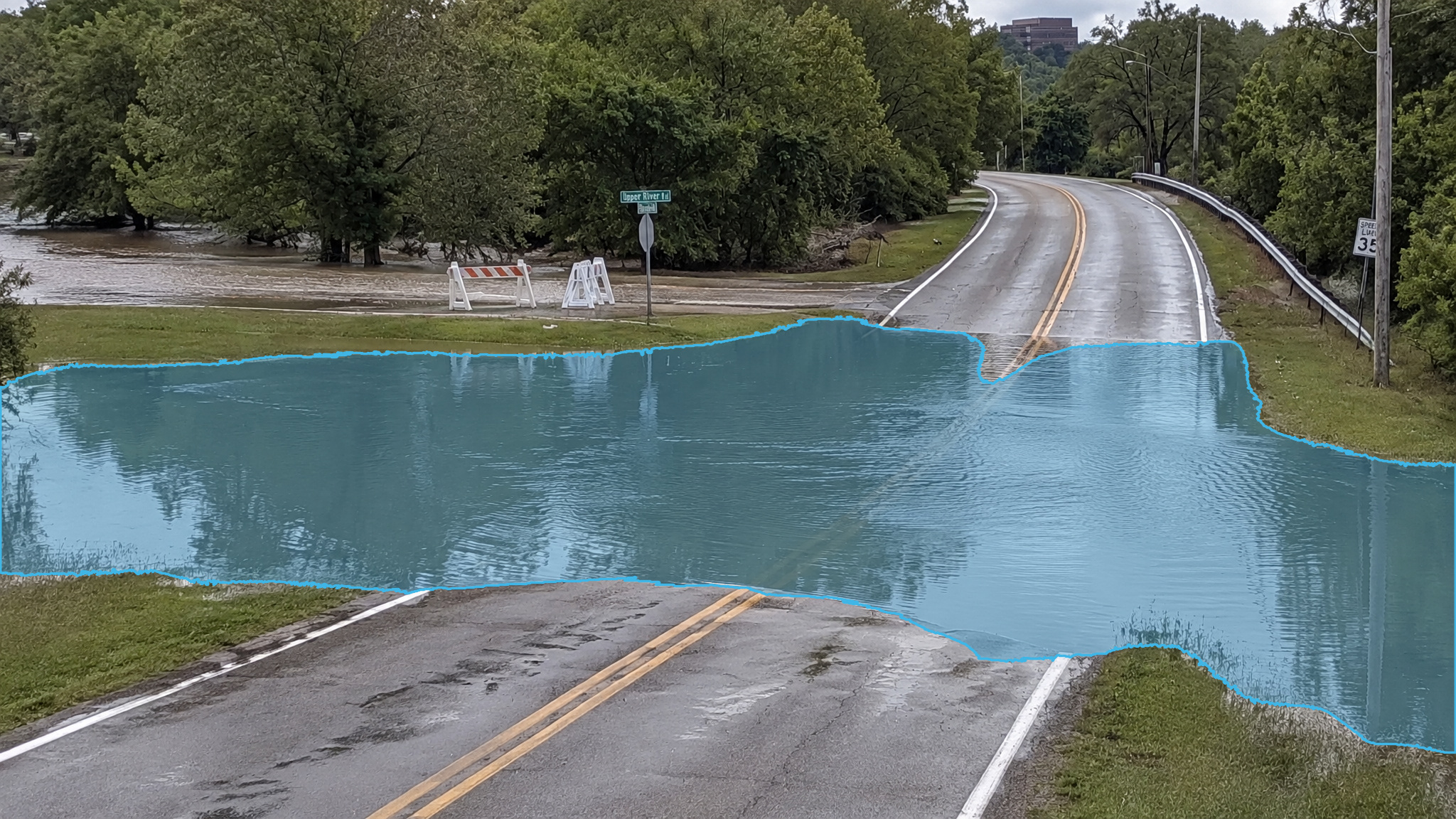
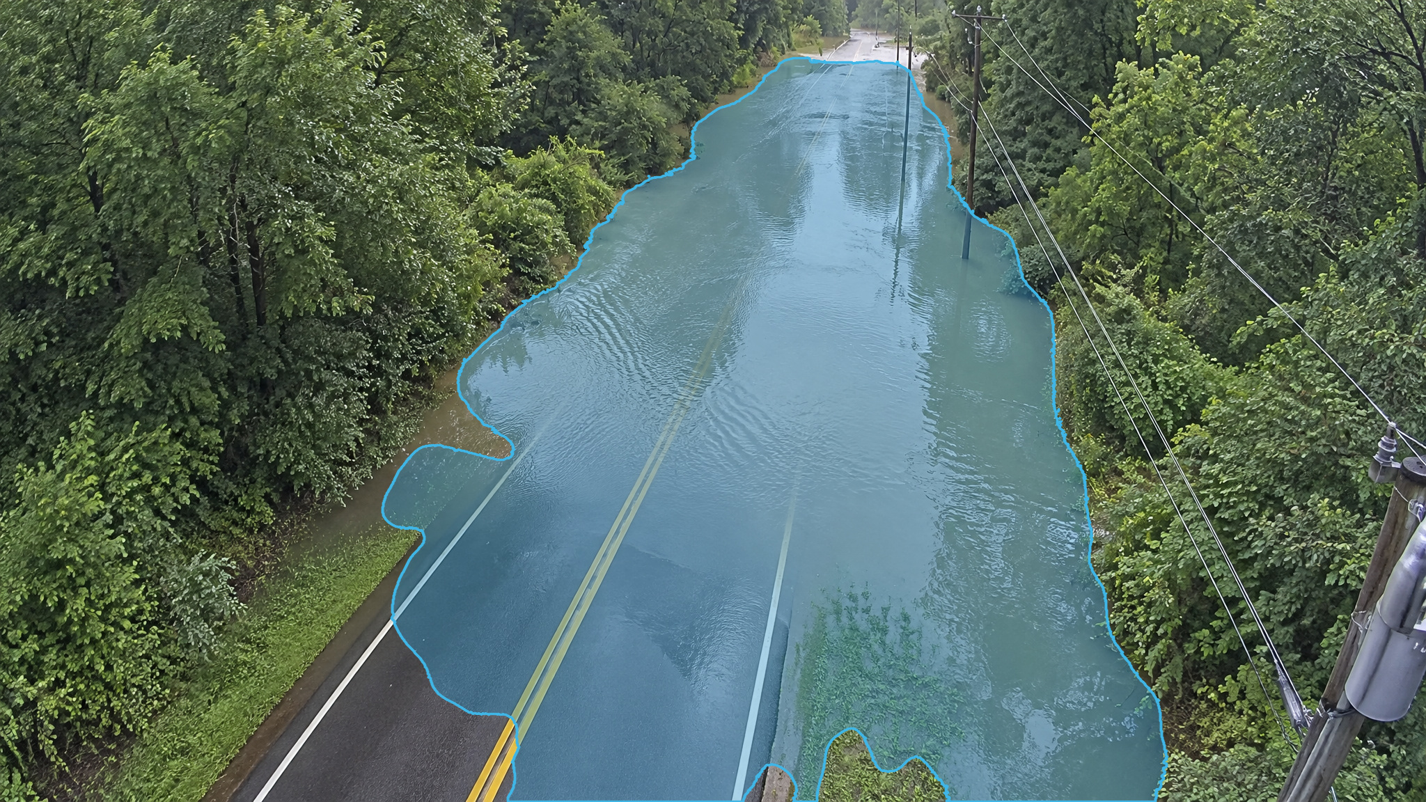
    Standing water on a forest road in daylight. Blue detection overlay marks the standing water.
    Forest road · Daylight · Detection overlayBlue marks standing water

    Low-point flooding, day and night

    Blue marks a puddle. Compare the original frame with its detection overlay: the same scene, not a before-and-after flood sequence. These examples do not expand the scope of the measured benchmark; scenarios outside those tested are not covered by the published figures.

    Daylight views

    Forest road · Daylight
    ·
    Standing water on a forest road in daylight. Blue detection overlay marks the standing water.
    Standing water on a forest road in daylight. Blue marks standing water.Full size
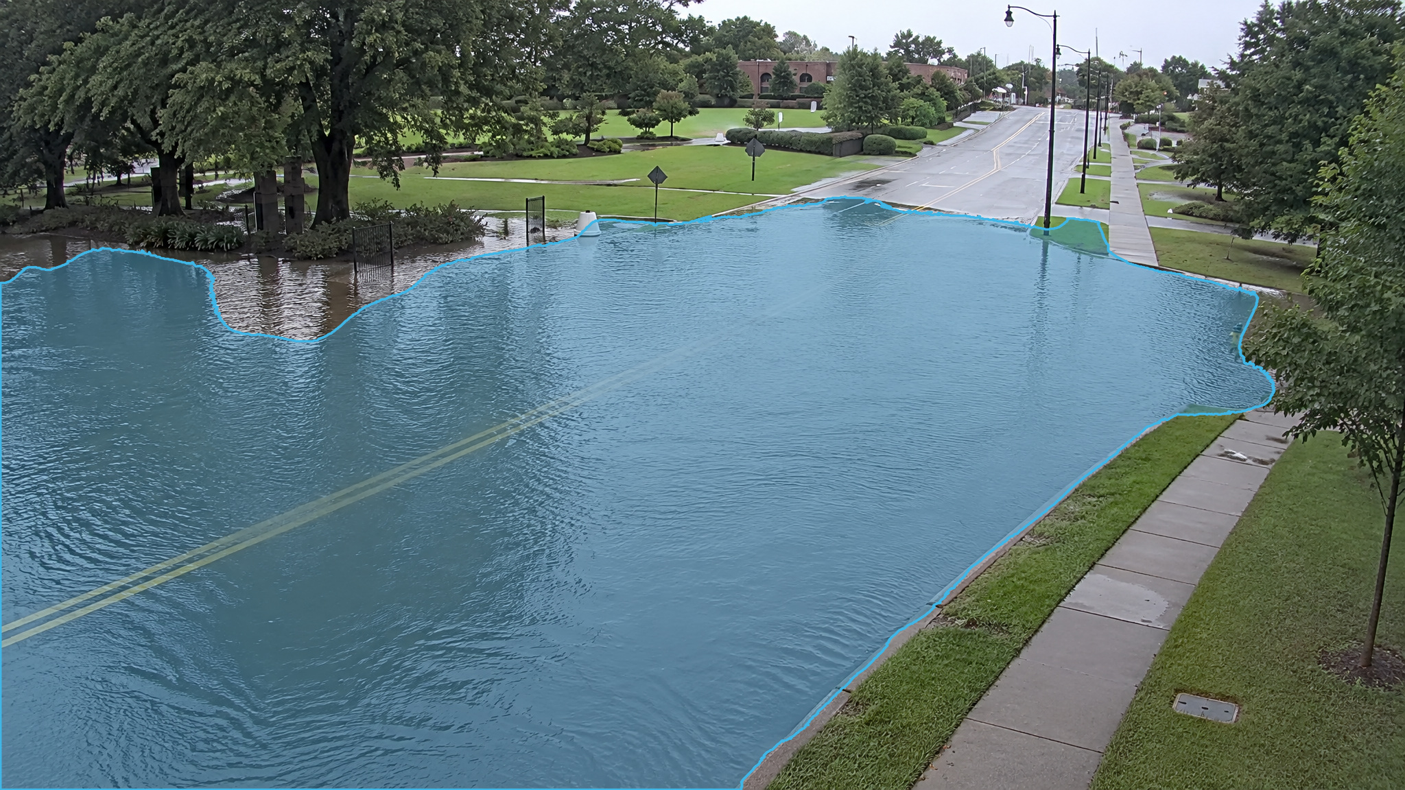
    Intersection · Daylight
    ·
    Flooded intersection in daylight. Blue detection overlay marks the standing water.
    Flooded intersection in daylight. Blue marks standing water.Full size
    Street · Daylight
    ·
    Flooded street in daylight. Blue detection overlay marks the standing water.
    Flooded street in daylight. Blue marks standing water.Full size
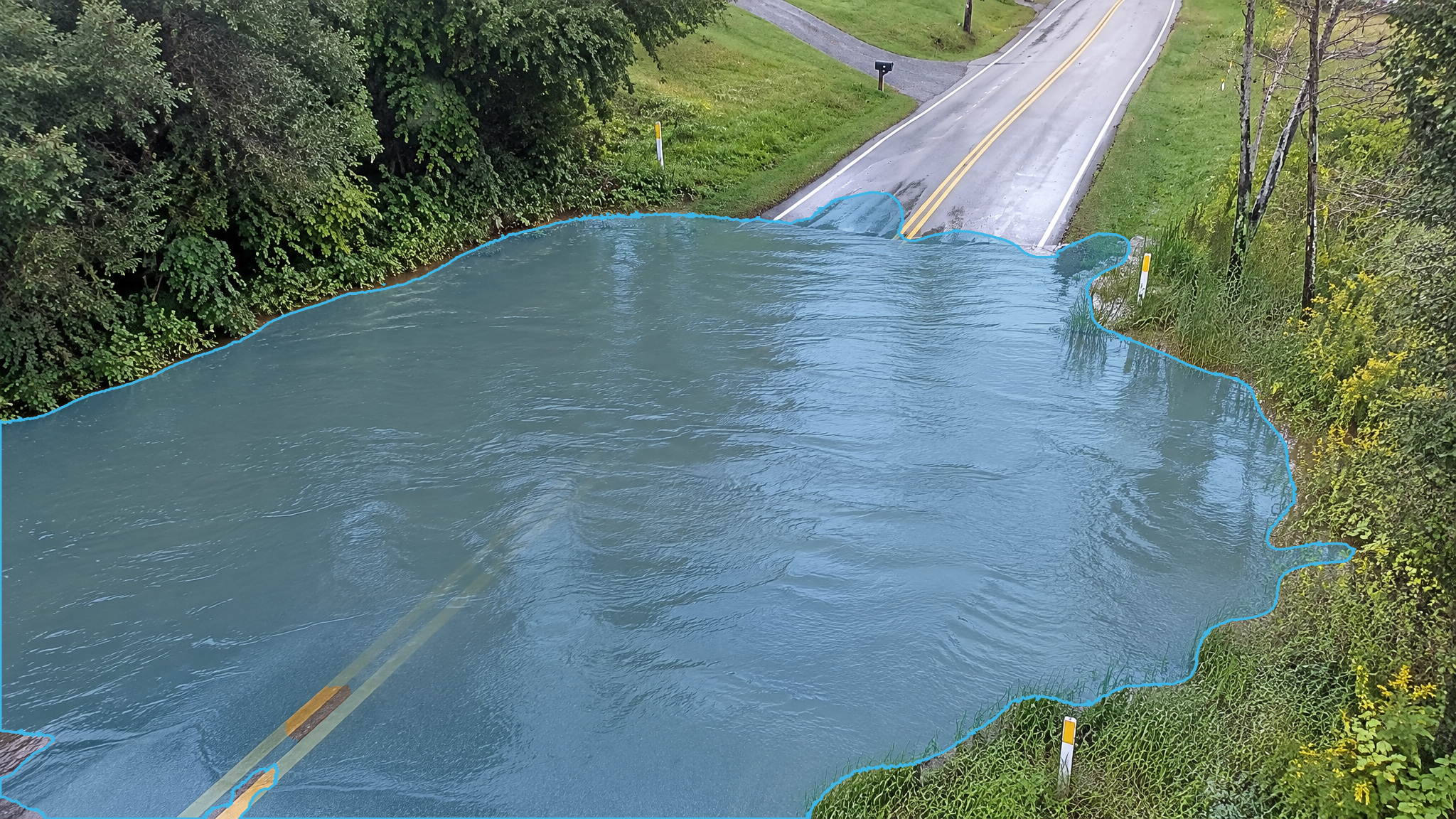
    Rural road · Daylight
    ·
    Flooded rural road in daylight. Blue detection overlay marks the standing water.
    Flooded rural road in daylight. Blue marks standing water.Full size

    Nighttime views

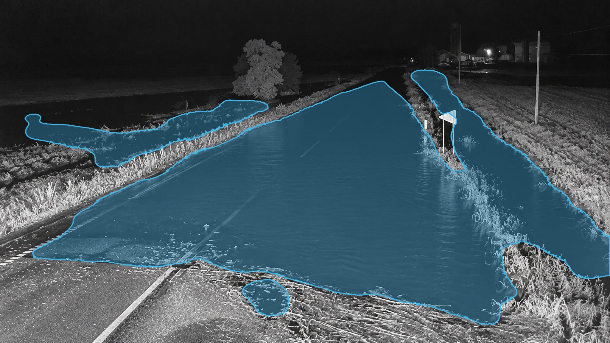
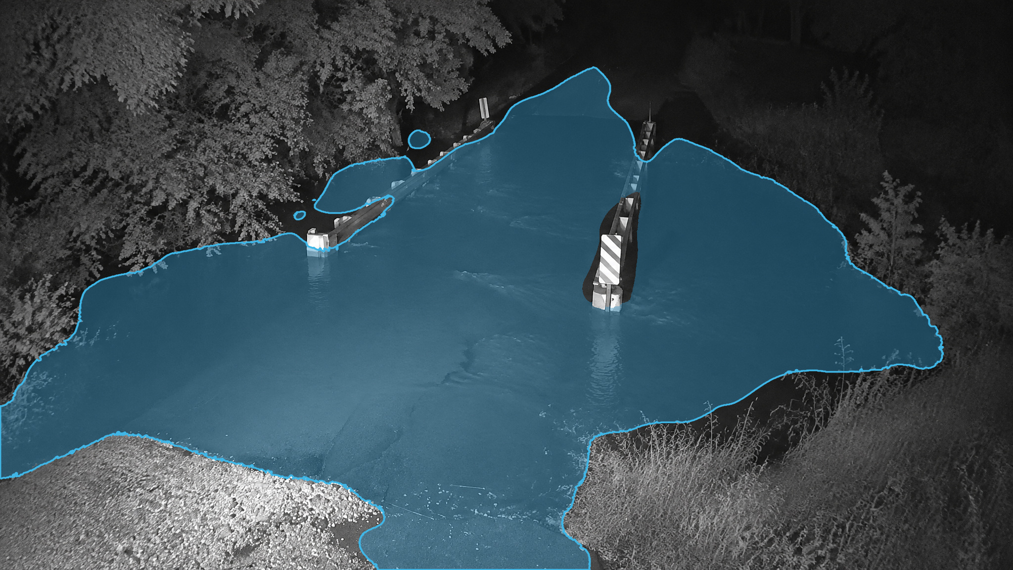
    Road · Night / NIR
    ·
    Flooded road in a near-infrared night frame. Blue detection overlay marks the standing water.
    Flooded road in a near-infrared night frame. Blue marks standing water.Full size
    Bridge · Night / NIR
    ·
    Flooded bridge in a near-infrared night frame. Blue detection overlay marks the standing water.
    Flooded bridge in a near-infrared night frame. Blue marks standing water.Full size

    01 / From camera to crew

    Watch the low point.
    Give the crew a view.

    Rain collects at the sag point of a road, in an underpass and at a low-water crossing when the inlets and catch basins cannot keep up, and the first report is often a stranded vehicle. Most of these sites already have a camera. What they lack is someone watching it.

    A sag point floods from the inlet out. The catch basin backs up, water spreads across the low lane, and the TMC hears about it from a stranded driver. The ITS camera that already covers the approach can watch it. V4 puts an interest zone on the pavement at the sag and reports standing water appearing and growing in the camera's view, staging the alarm up as it spreads. The alarm lands in the TMC's VMS and as a webhook to the dispatch or work-order system, with a snapshot, so a crew can set a lane closure before a vehicle is stranded.

    Sites and assets

    • Road low points, sag curves, underpasses and low-water crossings covered by ITS and intersection cameras
    • Storm drain inlets and catch basins where ponding starts

    What V4 watches for

    • Puddle: standing water appearing and growing in the camera's view at a road low point

    Vehicles and flood water

    The National Weather Service reports that over half of all flood-related drownings occur when a vehicle is driven into hazardous flood water, and that the location is often a road that dips down to the level of a stream channel. Seeing water pool at the sag point while it is still pooling is the window in which a lane closure prevents that.

    Barricades only help when a crew knows

    Texas law requires drivers to comply with barriers blocking low-water crossings or flooded roadways, and Louisiana's DOTD warns that flooded roads may not be barricaded at all. FHWA lists lane submersion from flooding among the causes of roadway capacity loss and counts about 12 percent of vehicle crashes as weather-related.

    Documented evidence

    Every alarm carries a timestamp and the original and overlay snapshots. When the water or the leak was detected, what it looked like and where it was are on record the moment it happened.

    02 / Existing cameras. Existing systems.

    How it is deployed in municipal and public works

    On-camera

    Where the city's ITS or intersection cameras are Axis ARTPEC-9 (available now) or Hanwha Wisenet 9 (ships November 15, 2026), the app installs on the camera. No server at the intersection, and nothing leaves the cabinet but the alarm. A PTZ on a tour carries its own interest zones and exclusion zones at each preset.

    On-server

    Where the TMC has a mixed camera fleet, a server takes RTSP streams from the cameras already on the network: an Emerson PACEdge industrial PC, an x86 server with an integrated Intel GPU or an NVIDIA GPU, or an NVIDIA Jetson, all shipping November 15, 2026. A fanless Jetson suits a roadside cabinet; a rack server in the TMC suits the camera fleet; the stream count per box is sized at quote.

    Into the systems the TMC already runs

    On-camera, native camera events go into the VMS the TMC already runs. On-server, alarm triggers go into Nx Witness, Wisenet WAVE, Milestone and AXIS Camera Station, with an overlay RTSP stream per channel. MQTT as JSON or Sparkplug B, pre-mapped for Ignition, into the utility's SCADA, and into DeltaV over MQTT on Emerson. HTTPS webhooks to email, SMS, ticketing or a BMS.

    Keep watching during the rain

    On a road low point the point is to watch during the rain, so the gate is left off there and the alarm stages up only when a detected pool grows and persists.

    03 / Know the limits

    Measured, not promised.

    The road-flooding image is a visual example, not an extension of the measured benchmark scope.

    Measured on 9,147 previously unseen frames, including true positives and negatives, out of the box with no per-site training, before the alarm engine is applied.

    F-scoreDetection rateFalse positive rate
    Puddle0.88997.1%0.8%
    Spray and visible vapor0.92398.1%3.7%

    F-score is the pixel-level harmonic mean of precision and recall. Frame-level figures; the alarm engine's staging, persistence and color-confidence checks exist so that a false frame does not become a false alarm.

    Scenarios outside those tested are not covered by these figures.

    Detection within seconds · Installed and configured in under 30 minutes · About 25 pixels per foot on target, nothing else

    Detection depends on the view, lighting and image detail. VisionAery Liquid Leak Detection does not identify chemical composition, detect invisible gas or measure concentration, depth or volume. It supports, not replaces, inspections, required instrumentation, cleanup protocols and safety procedures.

    Questions

    Frequently asked questions

    Does it measure how deep the water is?

    No. V4 reports standing water appearing and growing in the camera's view and stages the alarm up from green to red as the pool spreads and persists. It does not measure depth, volume or flow, and it does not identify the liquid. The snapshot shows the crew where the water is and how far it has spread; the decision to close the lane is theirs.

    Does it work in the rain? That is when the road floods.

    V4 was field-tested in every season, day and night, in rain, snow, wind and fog. The alarm engine stages up on growth and persistence, so a wet road surface that is not pooling does not stage up, and a pool at the sag point that keeps spreading does. The rain gate is an option, not a requirement; leave it off on a road channel. The accuracy figures above cover the scenarios tested, and a 30-day trial on your own low point is how we confirm it on your road.

    Can our existing traffic cameras do this?

    Usually. Any camera that streams RTSP can be watched by V4 on a server; Axis ARTPEC-9 cameras run it on the camera today, Hanwha Wisenet 9 from November 15, 2026. V4 needs about 25 pixels per foot on the pavement at the low point. Whether the signal-pole camera gives that at the sag depends on distance and lens; we check it from one frame during the trial.

    How does it reach the TMC and the utility's SCADA?

    On-camera, as native camera events into the VMS. On-server, as alarm triggers into Nx Witness, Wisenet WAVE, Milestone or AXIS Camera Station. For SCADA, over MQTT as JSON or Sparkplug B, pre-mapped for Ignition so the zone and alarm tags auto-discover. For anything else, an HTTPS webhook posts JSON, with snapshots if you want them, to any URL, with a test button.

    What does it cost, and can we try it first?

    $500 per camera channel per year with support and updates included, or $1,500 perpetual with a 10% annual support fee. Same price on every platform, on-camera or on-server. A 30-day trial is free, longer on request.

    Put a watch on the low points with the cameras you already own.